Tuesday, September 29, 2015

Day 27 - Sospel to Menton - The Med and Home


I started blogging about the hike with a Tour de France analogy and I'll finish it with one. The last day of the TdF is more a celebration than a bike race; it's a day for the riders to savoir and remember. And my last day on the hike was a bit similar - it's a procession to the Med. 

But behind the last day of the TdF, there's an invisible race. Just after the official race ends, many cyclists rush to catch a train or plane for some time with their families. And I have the same problem - I want to get home tonight and I'll have to hurry to catch the last train.


Italy to the L, France to the R, the Med below
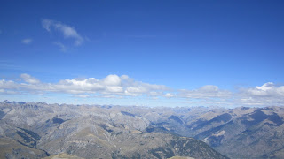
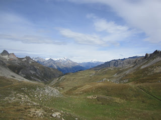
So I rush up the first climb to the Col du Razet; it's obvious then I can relax and enjoy my day. At the Col du Berceau Menton and the Med are spread out nearly 1100 m below. I climb onto the rocky ridge that forms the France-Italy border and drink in the scene. Then a long stroll down to the sea.


After 27 days hiking, the Med!
At the station in Menton I get a sad glimpse of the 'real' world; French police searching the train coming from Italy for migrants. Then the train journey home and seeing my wife at the station in St Andre.

Monday, September 28, 2015

Day 26 - Belvedere to Sospel - Bushwhacking Blues

It looks near but it isn't...
The first part of my hike involved walking to La Bollene-Vesubie. It's essentially at the same altitude and is only 2 kms away (as the crow flies), but the guidebook allows 2 hr 20 minutes for the hike. It's basically bushwhacking on steep wooded hillsides, with lots of little climbs and descents to make progress and no views at all. After the open hiking in the mountains, it's quite a disappointment; like going from hiking in the desert to the jungle. I'm not a happy camper by the time I arrive at La Bollene-Vesubie.

Looking back when climbing the Col de Turini by road

Instead of continuing on the 'trail' to the Col de Turini, I decide to follow the road. It's not very aesthetic, but it's a big improvement; every 12 minutes I cover 1 km distance and climb 75m. A little over two hours later I'm having a nice lunch at the col and I've another decision to make - I can head north on trails to join the GR52 or I can continue on the road to Sospel. I decide to continue on the road, partly because it will allow me to finish the hike a day earlier. So it's more tarmac pounding for me, this time downhill. Late in the day my feet are getting sore and I accept a lift for the last bit into Sospel.   

I get installed in a hotel in Sospel - the Auberge Provencal. It's quite nice but overpriced. Anyway, tomorrow will be the last day of the hike and I feel I can treat myself a little bit.

Sunday, September 27, 2015

Day 25 - SDV to Belvedere - Decisions

There are two conventional ways to finish the GR5 hike from St Dalmas Valdeblore. You can stay on the GR5 and in 2 long and reputedly dull days reach Nice and the coast. Or you can finish using the GR52 which takes about 5 days (it heads back north for a day), crosses some wonderful terrain and arrives at Menton. The GR52 is supposed to be much better and gives a spectacular arrival at the Med but... the high altitude refuges close today (3 days earlier than I'd read) and while I could still do the hike, it's not that practical with lightweight gear. So I've decided on a 3rd option; I will follow the GR52A for a couple of days and then finish the hike on the GR52. 

There are actually 3 GRs going through St Dalmas Valdeblore; the GR5, the GR52 and the GR52A. It would be easy to follow a wrong set of red and white signs, so I pay attention! A long descent to St Martin de Vesubie and then a long, boring hike in the woods takes me to Belvedere. At Belvedere I get installed in a comfy gite (Les Condamines); after a shower I sit down on a sofa and realize to my surprise that it's the first time I've sat so comfortably for nearly a month! I go down to the village to eat and find a nice pizza place.

Saturday, September 26, 2015

Day 24 - VDL to St Dalmas Valdeblore - Refreshing Ice Cream

The Vacherie de Longon and Mt Mounier in the morning 
The vacherie seemed just as enchanting in the morning. The wife and daughters had descended to sell cheese at the market in the morning so the husband prepared my coffee - he was just as friendly as his wife. After breakfast I bought some cheese and set off under a big blue sky. Within a few minutes the view of the 1400 m descent down to St Saveur appeared; it reminded me of the view down the Grand Canyon. I'm obviously leaving the mountains behind and entering the wooden hills near the cost. The descent was long and in the sun and I was plenty warm by the time I arrive in St Saveur and bought some sandwiches for lunch.
First view of the descent from the mountains

What comes down also has to go up and I had an even hotter climb up to Rimplas and then onto Bolline with thunder growling and a storm threatening.  I bought myself an ice-cream and, just as I started eating it, the rain started and the temperature plummeted - just like a TV ad! 

I layered up and hiked up to St Dalmas Valdeblore. The gite (Les Marmottes) was disappointing and it didn't surprise me - the woman obviously wanted to be closed or to have several guests and she only had me as a guest. But I had a nice surprise later in the evening; a hiker I had met in Maljasset arrived. He was a young lad carrying lots of gear and - despite taking a more adventurous route than me - had caught me up. I had someone to endure the mediocre evening meal with!

Friday, September 25, 2015

Day 23 - Roya to the Vacherie de Longon - Travelling Alone

The final ridge leading to Mount Mounier
I'm hiking alone and there is no-one else on the hike on the 'same day' as me. I know that there are a total of 7 people hiking a day ahead of me (I've been told that in the gite) and it would be nice to have a bit of company in the evening. But people interact differently with you when you are alone and today that worked in my favor.

The day stared with a long climb. At one point I went through a big herd of sheep (it wasn't really practical to go round them) and I met a total of 7 guard dogs, but they were pretty friendly. Then I had a decision - to climb Mount Mounier (2817 m) or not. It would add 2 hours to an already long day, but I felt like it. The top was the highest point of the hike and there were great views, including the snowy Ecrins to the north, the mountains around my home to the west and a hazy view of the Med to the south. 


Viewnorth from Mt. Mounier - the Ecrins in the center 
Afterwards the day seemed a bit long. After a long, gradual descent I had a short climb over a col (les Portes de Lognon, 1952 m) and then wonderful flat walking along a grassy valley to arrive at the Vacherie de Lognon. This is a working farm run that is also a refuge. I had an excellent welcome; a young daughter (7 or 8) showed me the dormitory and explained everything very well ("you can sleep upstairs or downstairs, but it will be warmer upstairs..."). The husband put some logs on the fire so I could read in comfort. Then the wife started baking - Friday is baking day - and she had 12 loaves to bake. 


Lovely hiking to the Vacherie de Longon
When the bread was ready, the wife shared some just baked socca (a specialty of Nice, a sort of cake made with chick-pea flour) and a home-made appertif and we chatted. At the same time, the two daughters prepared a couple of pizzas to go in the oven - one round, one square. The wife explained that they were in the course of moving everything down to the valley for the winter - the cows were down and the goats were going down tomorrow. After a while, she asked me what I wanted to eat and suggested an omelette (made with eggs from the hens roaming outside); I said yes. There followed a huge, excellent meal - I'm afraid I didn't quite finish the 5! egg omelette but everything else was consumed. An excellent evening! 


Thursday, September 24, 2015

Day 22 - St Dalmas le Selvage to Roya - Cash!

Garden near St Etienne de Tinee
This will probably be my easiest remaining day of the hike and the gite I'm heading to will only be open at 17.00, so there's no rush. I dawdle over to St Etienne de Tinee where I need cash! As I descend to St Etienne there are flowers and fruit everywhere - it seems almost tropical after yesterday's snow.

I get the cash and then I want to relax. I had visions of reading the newspaper in a cafe on the village square, discretely admiring pretty girls walking by. Alas, reality was different - the only newspaper shop was closed and the cafes were uninviting, so I continued my hike. After a steep, hot climb I arrived at Auron and found a pleasant but almost deserted ski-resort; I had a leisurely lunch and did some puzzles.  


Looking back to the Pas de la Cavale (U shaped col L of center)
Later in the afternoon I climbed over the Col de Blainon and strolled down to Roya. The gite had been recently refurbished and was very nice; I was the only person staying there, so I was well looked after! 

Wednesday, September 23, 2015

Day 21 - Larche to St Dalmas le Selvage - Indirect Observation

Snow on the climb to the Pas de la Cavale

Up and away by 8.00. There has been heavy rain overnight which has fallen as snow above 2000 m - not exactly helpful on a 3 col day. Five minutes into the hike and the rain comes down, so I stop to layer up. Thirty minutes later it stops, so I can layer down again and the hiking becomes more pleasant even if it is still chilly. A walk along a lovely flat valley is followed by a climb up past the Lac du Lauzanier to the first col - the Pas de la Cavale (2671 m). The snow isn't too deep but it still makes the climb a bit tricky.

Scientists are used to the idea of indirect observation. For example, a new planet may be detected as a wobble of a star rather than directly seeing it. And the Med, still not visible, is revealed by a long, low and unimpressive line of clouds (caused by its moist air) in the distance. Another little sign I'm getting near the end of the hike.


Observation of the Med via the clouds on the right
The rest of the hike is more straight-forward. The bad weather has passed and the mistral is blowing, but it is sunny and clear. Before the 3rd col I find an open cafe and stop for some coffee and clafoutis (like a fruit flan) and this puts be in a good mood for the final climb of the day (but reduces my cash reserves to 4 euros). 

I arrive at the chambre d'hote and spend an agreeable evening with two Swiss guests and the two hosts. The Swiss are German speakers; neither speak French but one speaks English and, as the hosts only speak French, I end up doing quite a bit of translating.


Tuesday, September 22, 2015

Day 20 - Maljasset to Larche - Cash Worries

Heading to the Pont de Chatelet - 97 m above the river. 
Today will be a long day (around 8.5 hours according to the guide) crossing a couple of cols to Larche. Murray had tried to persuade me to take a more adventurous route that went over some higher cols in Italy and it was tempting, but I was worried about accumulated fatigue. 

I'm on the road (literally, because the first part of the hike follows the road) before 8.00. It's chilly because the sun hasn't reached down into the valley yet but dramatic views offer recompense - the rising sun is lighting up big rock walls. I cross an 'interesting' bridge have second breakfast at Fouillousse. From there, I have a long stretch of hiking over a couple of cols to arrive at Larche. We're really into wilder country here - I don't see any other hikers all day (in fact, I hardly see anyone). 


Starting the climb from Fouillousse to the Col du Vallonet
At Larche I get installed in the gite and I have a little problem to resolve. I should have got some cash in Briancon, but it just slipped my mind. Once I pay for the gite in Larch, I'll be out of cash (Larch has no cash machines, and no-one is credit card enabled). I phone my wife and she finds out that the nearest cash machine is 4 cols and about 12 hours hiking away - ouch! But I phone a chambre d'hote and agree I'll pay via a bank transfer, so that shortens my hiking tomorrow to 10 hours, with 'only' 3 cols. The weather is obviously changing for the worst so that's a relief!

Monday, September 21, 2015

Day 19 - Ceillac to Maljasset - Two Lakes and a Col

Lac des Pres Soubeyrand
I'm really looking forward to today's hike because I'm going to stay in the refuge at Maljasset. I've never been to the hamlet but I've heard it described as a Himalayan village - right at the end of a long, high, isolated valley just before the Italian border. I've also heard good things about the hut. 

To get there I have a big climb over the highest col on the hike - the Col Girardin at 2700 m. The initial climb goes up through some open forests and then passes two lovely lakes. The first is the Lac des Pres-Soubeyrand and it's surrounded by grass and forest. The second - Lac Sainte-Anne - is a strikingly blue and surrounded by rocky peaks and moraines left by disappeared glaciers. I'm in no rush - today's guidebook time is a tad over 6.5 hours and today may be the shortest day left on the hike - so I linger. Then a short climb takes me up the Col Girardan. From here there are great views in all directions. I can see into the Ecrins, including the Glacier Blanc and La Barre des Ecrins (4102 m); this is a bittersweet moment , I climbed it on skis around 25 years ago and I've just learned two of the people I climbed it with are dead.

Lac Sainte Anne and the Ecrins from the Col Girardin
At the col I also entered my own department (like a county) - the Alpes de Haute Provence - and it's really the first sign I'm getting near the end of the hike. A steep descent to Maljasset and I get installed in the excellent hut. After a shower I read outside - it's a very pleasant temperature. There are quite a few people staying in the hut and the evening meal is very convivial; it is also excellent - thick vegetable soup (more like a stew), polenta + sausage and lots of apple crumble - maybe the best on the hike.  

Sunday, September 20, 2015

Day 18 - Brunissard to Ceillac - the Queyras

Descending to Chateau Queryas
The region I'm hiking in is called the Queyras. So far, I'd say it is the most attractive part of the hike - the peaks are high and rocky, but the valleys are grassy and the forests are very open. It's also a less busy than the northern alps and the villages are more traditional. Of course, the weather is lovely, so that helps too! 


On the descent to Ceillac
After a couple of hours hiking, I descend through the trees to Chateau Queryas, before a long climb in the heat of the day to the Col Fromage (2301 m). It was a bit of a grind at the start but got more pleasant higher up. The last 30 minutes or so to the col were almost flat with wonderful views in all directions. From the col I had a long descent to Ceillac. There were 3 or 4 paragliders flying over the village but they landed just before I arrived. The village is very nice; although it has become a small ski-resort it is still a real village, with houses, shops, restos and the like. I get installed in a run down hotel (very poor value!) and then have a decent omelette in a resto. 


Saturday, September 19, 2015

Day 17 - Briancon to Brunissard - Three Degrees of Separation

Today's stage isn't very long and is relatively simple - a climb over the Col des Ayes and a stroll down the other side. So there's no rush and I have a leisurely breakfast with Murray before preparing some sandwiches with the contents of his fridge. Murray drops me off back on the hike and it's back to work!

The weather is excellent - clear but cool - and the scenery is very pleasant - the meleze forests are light and airy. As I lunch on the col a couple of ladies climb up and join me. I leave them and descend to my gite. Once there it seems deserted, so I phone and say I'm outside. The woman on the other end tells me she is outside too, but can't see me! I had to try several gites before reserving one, and it turns out that I got a bit mixed up. I wrote down the correct phone number but the wrong name once I made the reservation. The correct one was 20 minutes walk away (back the way I had come) and by the time I arrived the two ladies were there!

Over the evening meal I found out that they were gardiennes in a refuge that had just closed and they were doing the hike. They knew Murray's girlfriend (who is also a gardienne) - it's a small world.


Friday, September 18, 2015

Half Time

In the morning I say my good-byes to the other three and then head to see Murray. Murray lives just outside Briancon - he's a mountain guide and I've known him for almost 40 years - and I'm going to spend the day with him and continue the hike tomorrow. I've enjoyed hiking with the other three but I'm also looking forward to hiking by myself.

I have a nice day with Murray (and wash my clothes!). In the evening I phone up to book accommodation for the next few nights and I see the big problem to complete the hike. The southern half of the hike is wilder (less villages, no towns, fewer hikers) than the northern half, so there are less refuges and gites. For a lightweight hiker this means longer days with fewer choices. At this time of year the huts and gites are starting to close and this compounds the problem. 

But I can now see that, despite the gites advertising a closing date (they have to, to be included in the guide), the closing actually happens 'flexibly'. A gite will stay open if it has a reservation for 10 people, but is less keen on a reservation for one person. So when I phone up to ask if I can reserve accommodation, the first question is always 'for how many people'. So I might have some long day's hiking in my future...      

Thursday, September 17, 2015

Day 16 - Nevache to Briancon - Epic Day's Hiking

The weather is reasonable when we get up. But we know there will be 50 km/h winds once we cross the first col at 2500 m. We've looked at a multi-model forecast (basically, about 12 forecasts using different models) and they all show cold temperatures and have rain of some form; a couple have isolated showers, some frequent showers, other have a sustained period of rain, a couple have thunderstorms - but none shows snow at our altitude. The day's hike is about 8 hours to Briancon and we rationalize that, if the weather is too bad, we can either turn back or - at about half distance - descend to Serre Chevalier to get back to valley level. We also discuss the importance of walking at a steady pace - we won't want to stop for rests.

The start of the hike is dry and quite pleasant but we can see rain approaching. Not far from the first col, just below the tree line, we stop for some food and to layer up as the rain starts. Above the tree line it's wet and windy but it's once we cross the col - and get out of the lee of the mountain - that the weather hits us. We're in the clouds and the wind is very strong and straight in our faces, driving the rain into us. 

We basically keep hiking for the next 4 and bit hours. It's not very pleasant but my rain-gear is doing its job and I'm mostly dry. The others seem to be doing fine and there's no discussion of turning back or escaping down to the valley. Eventually the rain stops, shortly after the sun comes out, we stop to eat and remove some layers - broad, relieved smiles all round. 

Briacon - citadel center left, other defenses top left  
The rest of the hike is very pleasant and we reach La Croix de Toulouse, a great viewpoint of Briancon. Briancon is a fortified town (it's basically on the French - Italian border) and the defenses are something special. We descend into the citadel and have our photos taken. 

This is the end of the hike for Jill, Rohan and Rahul so they are a bit demob happy. The first two will head back to the States in a couple of days and Rahul is going to do some travelling in Europe. We find a decent hotel and then find a great resto and Rahul treats us all to an excellent meal.   
The ones smiling have finished the hike


Wednesday, September 16, 2015

Day 15 - I Re Magi to Nevache - Wild Clouds

Clouds and wind in the descent of the Col des Thures
We woke up to a nasty surprise - heavy rain, not what was forecast. We also know that some very bad weather is due tomorrow, so we got ready very slowly and discussed different strategies to reach Briancon. We decide to go to Nevache today; it's a short day, up over the Col des Thures. We climb up in the mist with some light rain but things improve dramatically as we reach the top. Clouds are swirling around all over the place; we see another hiker 100 meters away, but then the clouds swallow him up. The rest of the hike is dry and pretty spectacular. 

We stop in Nevache for a steak frites and then continue to our gite. We have a so-so evening meal and look nervously at the forecasts for tomorrow.

Tuesday, September 15, 2015

Day 14 - Modane to Refuge I Re Magi - A Taste of Italy

Looking north from the Col de la Vallee Etroite
After an excellent breakfast we bought our lunch sandwiches and headed out of Modane. It was cool after overnight rain and the hiking was pretty dull initially - a long, steep climb in the forest. The hiking slowly improved and was quite pleasant for the last bit up to the col - and the end of a 4.5 hour uphill slog.

The Col de la Vallee Etroite marks the boundary between the northern and southern alps. Today things were the 'wrong way round' - better weather to the north, grayer skies to the south. We had a chilly lunch, hiding from the wind, and then continued the hike, descending the Vallee Etroite (narrow valley). The vegetation had changed - the high altitude trees were now melezes (larch).

The Vallee Etroite is very interesting; it was Italian until 1947 but is now officially French. In reality, it seems more Italian than French. Cars had Italian plates; signs were in Italian, then French; and our refuge (sorry, rifugio) was also Italian - il Rifugio i Re Magi. 

The gardiens didn't speak English and my Italian is a bit rusty so we spoke in French - it's unusual to use French as a common language with a non-native French speaker. The hut was excellent, with a pleasant reading area outside the bedrooms. But the evening meal was (by hut standards) outstanding. The dining room had lots of windows but was very cozy and we could enjoy views in every direction. We were served a first course of five little appetizers; the main course was polenta and sausage; a cheese course then panna cotta; all with wine and grappa included in the price. Absolutely outstanding!


Monday, September 14, 2015

Day 13 - Termignon to Modane - Le Petit Bonheur

Today we will be walking down the Arc valley to Modane; it's a relatively short, easy day. But I will have a little moment of truth today. There are 4 topo-guides (combined guidebook + maps) for the whole hike and they each weigh 200g. Rather than carry all 4, I've been carrying 2 and the next 2 should be waiting for me in the post office at Modane. I need to collect them and send the 'old' 2 home. So I want to get to Modane early enough to sort out any problems.


'Italian' Forts to defend against France
The hike to Modane is pretty flat but not uninteresting; it's called Le Petit Bonheur (the little happiness). At one point we hike up a bob-sleigh run. There are exhibits that claim this is (maybe) where Hannibal crossed the alps with his elephants. There were impressive forts, built to protect against French invasion (the frontiers have moved over the years). We have lunch together but afterwards I go ahead to make sure I get to the post office on time; everything goes according to plan.

We get back together again and Jill has a flapping boot; we get glue at a hardware store and repair it (fortunately this happened at a decent sized town...). Modane has a well deserved reputation as an ugly town, but we found a reasonable hotel and had a nice meal in a pizzeria. After the meal we were given some grappa, which I found a bit rough but managed to drink. 

Sunday, September 13, 2015

Day 12 - Entre Deux Eaux to Termignon - Bad Weather

For the last 3 days or say, the forecasts have shown a nasty weather system and it finally arrived in the night. We awoke in the clouds with heavy rain falling and we could see new snow from around 2600m - about the height of the cols we were due to cross. We lingered over breakfast and packing up, hoping the weather would sort itself out. By the time we were ready to leave, the rain had almost stopped and we were just out of the clouds. 

We decided to change to a lower level route, so we booked a hotel in Termignon (in the Arc valley) and headed in that direction. As we hiked the weather cleared up and we were soon able to take off our rain gear. Snowy peaks started poking through the clouds and it turned into a very pleasant day's (mostly downhill) hiking. 

Our hotel (L'Auberge La Turra) was very nice. Severine and David had taken it over recently and they made us very welcome - the rooms, food and price were all excellent. So far we've had a fair bit of bad weather on the trip, but we've managed to work around it and it hasn't spoiled any of our days. 


Saturday, September 12, 2015

Day 11 - Col du Palet to Entre Deux Eaux - Manhattan in the Alps

In the middle of the night all the stars were out, but things had clouded over by the morning. We left the refuge and headed down from the Col du Palet towards Tignes. Straight away we were in the ski area, so there were chairlifts and the like, but it still looked and felt natural.

Then we headed over a little rise and, suddenly, like a slap in the face, there was Tignes below us; a huge abandoned ski-resort. From above we could see 10 tennis courts, 2 or 3 soccer pitches, a golf course, acres of car parking as well as high rise buidling. At Tignes we split of from the GR5 to join the GR55 for a few days and we had to walk through the completely deserted town - both sad and spooky. We passed a Club Med surrounded by weeds. I'm sure it's an efficient place to ski but the resort is placed high (2100 m) to get the snow and isn't based on any 'natural' or existing village. It really was quite a shock, especially just on the boundary of a national park (with super strict rules). 

Once we left Tignes behind the hiking was quite nice; some sun and clouds with a chilly wind. For a large part of it we were walking in a very barren, almost Tibetan valley below a glacier where there is some summer skiing. We arrived at our destination hut, the Refuge de la Leisse. Our 'welcome' was puzzling - there was no beer or red wine, the only showers were cold. The motivation of our 'host' became clearer right away. The hut was closing tomorrow, they were having a party (a party without beer?) tonight and they didn't want us there to distract them. So we moved onto the next hut, the Refuge d'Entre Deux Eaux where we got a real welcome, a decent meal and really enjoyed ourselves. 

Friday, September 11, 2015

Day 10 - Landry to the Refuge du Col du Palet - Big Climbing Day

After our rest day we got up early in Bourg and a disappointment - rain! On the bus back to Landry showers are still falling, but they have more or less stopped when we re-join the hike. Today is a long day with 1800m (6000 ft) of climbing so we take it easy - we're a bit worried we might encounter new snow near the hut. We start in the Isere valley and climb up though forests and small ski-resorts; it's still gray and damp. Higher up we get into a more open valley and we have a pleasant lunch at a pretty hamlet (Les Lanches) before entering the Parc National de la Vanoise.

We're pretty much above the tree-line for the second half of the day. The weather improves, and things look very nice with clouds, bits of blue sky and fresh snow on the tops. After a lot of walking (all snow-free) we arrive at the hut and it's very nice - we're the only guests. Just before the evening meal a party of 3 arrives, carrying camping gear and food etc. Two of them are so tired after their day, they check into the hut and eat with us. I'm glad we're doing this as a lightweight trip!

Wednesday, September 9, 2015

Day 9 - Refuge de la Balme to Landry - Descent to the Isere

I woke up early and couldn't get back to sleep, so I got up to read. The gardienne made me a pre-breakfast coffee and chatted a bit - this really is a good hut! After our breakfast, we headed out for a long, mostly gradual descent to the Isere valley. The walking was very pleasant until we reached the valley, then we had a bit of a slog along it to Landry. 

Tomorrow will be our second rest day, but Landry isn't very interesting, so we are going into Bourg Saint Maurice (often just called Bourg), a decent sized town. There is only 6km between the two places but we intend to get there by train, or bus or taxi. We arrive at Landry station, which is completely deserted; but a monitor seems to indicate that a bus will arrive and take us to Bourg. Amazingly, that's exactly what happens - the bus arrives, the driver seems amazed to see anyone at Landry station and takes us into Bourg.

In town we find good food, a decent hotel and everything we need for a decent rest day. My feet are looking forward to it!


Tuesday, September 8, 2015

Day 8 - Two High Points

Crete des Gittes
Today is a long day - from the Refuge du Col de la Croix du Bonhomme to the Refuge de la Balme Tartenaise (it's even long to type...) - so we were up early. There were two high points and we encountered the first one almost straight away. The Crete des Gittes is a sharp ridge that had a path made in it for military purposes - it's airy but straightforward (at least, when there is no snow). The sun was at a low angle, and this made the crest look even sharper. The rest of the morning was less spectacular but enjoyable walking, and we stopped for lunch before the climb to the Col de Bresson. 

We made our own ways up to the col and I hiked up with a trail runner. He was happy with my climbing pace and was expecting to do Chamonix to Nice in 15 days; he said he didn't actually run, he just walked fast and did 'double days' - about 12 hours. I waited at the col as he continued and soon we were reunited; Rahul and Jill continued to the hut while Rohan and I went on a little side-trip to try to get decent photos of the day's other high point. 

La Pierra Menta
La Pierra Menta is a huge rocky mountain - like one of the Chamonix aiguilles or a huge pinnacle. You can only get to the summit by rock climbing and we weren't equipped for that. Our quest for decent photos was thwarted by low clouds and flat light (it gets the best light in the early morning) but it still was quite a sight.

Our hut was very nice, easily the best so far of the hike; after yesterday's crowded hut on the TMB, we almost had the place to ourselves. There was a wonderful cooking smell and the meal really delivered; interestingly, the menu was the same as the previous evening (lentil soup followed by daube), but it was twice as good. When I had reserved it, the lady taking my booking wanted to make sure I had the right hut. Apparently there are three huts called the Refuge de la Balme and they are within a (long) day's hike of each other, so it's hardly surprising that people make mistakes!


Monday, September 7, 2015

Day 7 - Le Pontet to Refuge DCDLACDBH - TMB Crowds

We had another day in common with the TMB so there were lots of others hikers. The weather was lovely, with a blue sky and frost on the ground. It was also a mostly climbing day and on the open hillside it seemed there were hikers everywhere. We took it easy and enjoyed the views as we climbed and had lunch at the Col du Bonhomme. From there the path climbed over some rough ground to our hut. The rough ground caused a little bit of a traffic jam.

Looking back at the Col du Bonhomme
Our hut's name was a bit of a mouthful - the Refuge du Col de la Croix du Bonhomme. When we arrived it was absolutely packed. We got settled into our four person room and then drank some beer and were glad to see the hut starting to empty. It seems that the majority of TMB hikers continue for another couple of hours, but they stop for refreshments at our hut. Even after those hikers headed on, the hut was still plenty busy but the staff were pretty efficient. After our meal we saw a couple of bouquetin (ibex, a wild goat) on the ridge to the west, silhouetted against the setting sun. 

Tomorrow we will split up from the TMB and we're all looking forward to it. I really shudder to think what the TMB must be like in July and August. It will also mark a change in how we book our accommodation; up to now we had pre-booked, but from now on things should be quieter and we will phone ahead a day or two in advance.
   

Sunday, September 6, 2015

Day 6 - Chamonix to Le Pontet - The TMB and Trophy Tourism

The gite in Chamonix - Le Chamoniard Volant - was a mighty disappointment and we were very happy to leave it. It was clear but chilly - Mont Blanc casts a big shadow over the Chamonix valley in the morning. After yesterday's weather everyone was delighted to see the mountains above Chamonix - they really are spectacular. We rode the shuttle - full of expensively dressed outdoor types - to Les Houches and rejoined the hike.

Mountains - including Mont Blanc - above Chamonix
We had a fairly straight-forward day, climbing up the Col de Voza, then down to a wide, grassy valley which we followed past Contamines-Montjoie to our gite, in the camp-site at Le Pontet. All that, with ever changing views of Mont Blanc.

Today's route was common with the very popular TMB (Tour de Mont Blanc) hike and we saw a lot more hikers as a result. The TMB is a lot more accessible than the GR5 - it's shorter (7-10 days, instead of 30-40 days). As a result there is quite a TMB industry and hikers come from all over the world to do it. One of the parties in the gite was Chinese, with 8 walkers accompanied by a Chinese leader that spoke good French and also a qualified French leader to look after them in the mountains. 


Saturday, September 5, 2015

Day 5 - Refuge de Moede-Anterne to Chamonix - Bad Energy Trading

Forecasts were poor and turned out to be correct - we woke up in the clouds. We had a short day and we were heading to an incredible viewpoint for Mont Blanc, so this was a major disappointment. Some forecasts suggested things might get better in the afternoon, so we clung to this hope and did everything as slowly as we could. 


A wonderful view - bit is is also hidden
Finally, though, we were outside and walking in a Scottish style day; it wasn't raining or windy, just cold, damp and misty. For much of the hike we were just below the clouds but we had to climb up the Brevent and that took us into the clouds. The bit before the summit involved some ladders and was quite fun. I had been here skiing 25 odd years ago on a lovely day so I knew just how good the view was. But the others had to take my word for it. 

The official GR5 avoids Chamonix and descends to Les Houches; it is a long, steep, rocky descent with a reputation for harming knees. I thought it would be a good idea to preserve our knees and also to see Chamonix, so we had no compunction riding the cable-car down. You had to buy your ticket at the bottom, when it was to late to decide if the price was worth it. 

Well, it was an exceptional bargain for the cable-car company. We gave the company around 4.5 MJ (megajoules) of potential energy - enough energy to power an electric heater for an hour. They used this to raise another cable-car full of fair-paying passengers (one goes up as the other goes down). For giving this energy to the company, we were charged 90 Euros. Hmm... 

Friday, September 4, 2015

Day 4 - Samoens to Refuge de Moede-Anterne - A Long, Lovely Day

After breakfast we trudged back into Samoens to stock up on lunch and rejoin the hike. We had a long day ahead of us. First, we spent a couple of hours walking along the valley bottom (an unusual event on the GR5) livened up by climbing some ladders in a gorge. Then, a long, dull climb in the forest, brightened up by a couple of big waterfalls. But then we cleared the forest at the Collet d'Anterne and the day came alive, with views in all directions.

Lac and Col d'Anterne
We were heading south with a long line of high cliffs on our right - the Rochers des Fiz. Below the cliffs, the soil was clay and - apart from various grasses - there was very little vegetation. It was all very austere. After lunch we reached the first refuge (Refuge Authur Wills) as a group but then split up as everyone followed their own pace for the last stretch to our hut. The austerity continued past the Lac d'Anterne to the Col d'Anterne (everything around here is d'Anterne); at that point there were teasing views of the big mountains above Chamonix.

Aiguille du Midi and Glacier des Bossons
A short descent lead to our hut (the Refuge de Moede-Anterne), a shower, beer and a nice meal (polenta and sausage - we'll eat that again several times on the hike).

.  

Wednesday, September 2, 2015

Day 3 - Refuge de Chesery to Samoens - Hidden Views

Some mountains are hiding...
We got up after the Welsh had left and enjoyed a late breakfast. The overnight rain had stopped and the sun was out, though there were lots of low clouds. We knew that there were some great views hiding behind the clouds - including the Dents du Midi - but they refused to show themselves. After yesterday's little drama we took things easy and enjoyed the views we did get. While we were still in Switzerland, we stopped for some coffee at a farm and were able to pay in Euros. 

Over two cols, back into France at the first one, meeting some of the Welsh party and some Northern Irish and then onto a long descent to Samoens. We were taunted by a succession of sign-posts saying that Samoens was 55 minutes away before we finally arrived in the town. The main square was very pretty and we drank a beer and took in the atmosphere. Our gite - les Fermes du Vercland - is a bit out of town so we phoned for a taxi and it arrived just as we finished our beer. 

None of our first three days were huge, but they were still three solid days. We've scheduled a rest-day to give a reasonably easy introduction to the hike. Both Samoens and the gite look like a good place for our first rest day. 

Tuesday, September 1, 2015

Day 2 - La Chapelle d'Abondance to the Refuge de Chesery - A Little Scare

On the GR5 you tend to spend the night in a gite in a valley (at around 1000m) or up in a refuge (over 2000 m). The nature of your day depends on where you start and where you finish it. Today was a gite to refuge day, so lots of climbing. As the refuge was in Switzerland we had a bonus border crossing.

The weather was cool, gray and windy but at least dry, though rain was forecast for the late afternoon - motivation to get to the hut before it! We stocked up on lunch material in Chapelle and headed out. Rohan and I drifted off the front towards the top of the long initial climb to the Col des Mattes. It would obviously be a longish, cold wait, so - after a quick phone call with the other two - Rohan and I went ahead. A couple of hours later, we found a sheltered spot for lunch and waited for the others.

Looking S from the Col des Mattes - we'll take the track on the L
We'd eaten all our food by the time the other two arrived, so we exchanged some route information with them (it all seemed pretty straightforward), wished them bon appetit and left them to it. The hut was in the clouds when Rohan and I arrived, but we beat the rain. As we were showering and drinking beer, Rahul phoned to say they had missed a turning and were lost and it was raining. At the same time, the hut started slowly filling up with a party of 17 Welsh and they were plenty noisy. Eventually, we were able to guide Rahul and Jill to a col on the GR5 and they met the tail end of the Welsh party and rejoined us - a bit damp - shortly before the evening meal. Phew!

The hut was bursting at the seams; everyone was glad to be inside as the rain lashed down. The meal was noisy, there was drinking before, during and afterwards but things calmed down as tiredness set in. The 17 Welsh were in a dormitory for 16, so one got voted off the island into our dormitory and - surprise, surprise - he was a snorer. That's why you carry ear plugs!