Showing posts with label Hiking. Show all posts

Tuesday, July 5, 2022

Day 9 - Refugio de Belagua to Lescun

I've got a long day today if I want to get home tonight. According to the guidebook it's a little over 7 hrs to Lescun; but then I've got over 2 hours hiking to the station at Bedous to get the train back to Pau. Of course, there's also the possibility of getting a lift from Lescun to Bedous…

Pleasant hiking in the beech forest

I get away just after 8.30 and the route goes through a shady beech forest - very pleasant hiking. It's a gradual but steady climb but as I gain altitude the scenery becomes more rock and less vegetation. The rock in this part of the Pyrénées is limestone and it gives a crazy 'karst' landscape. I experienced it when I climbed the nearby Pic d'Anie and found it a little scary. Rock features like crevasses, little cliffs and pinnacles form a maze, just like a glacier, and getting to a point just 100 m away can involve lots of back-tracking and detours. You can waste a lot of time! 

A maze of limestone

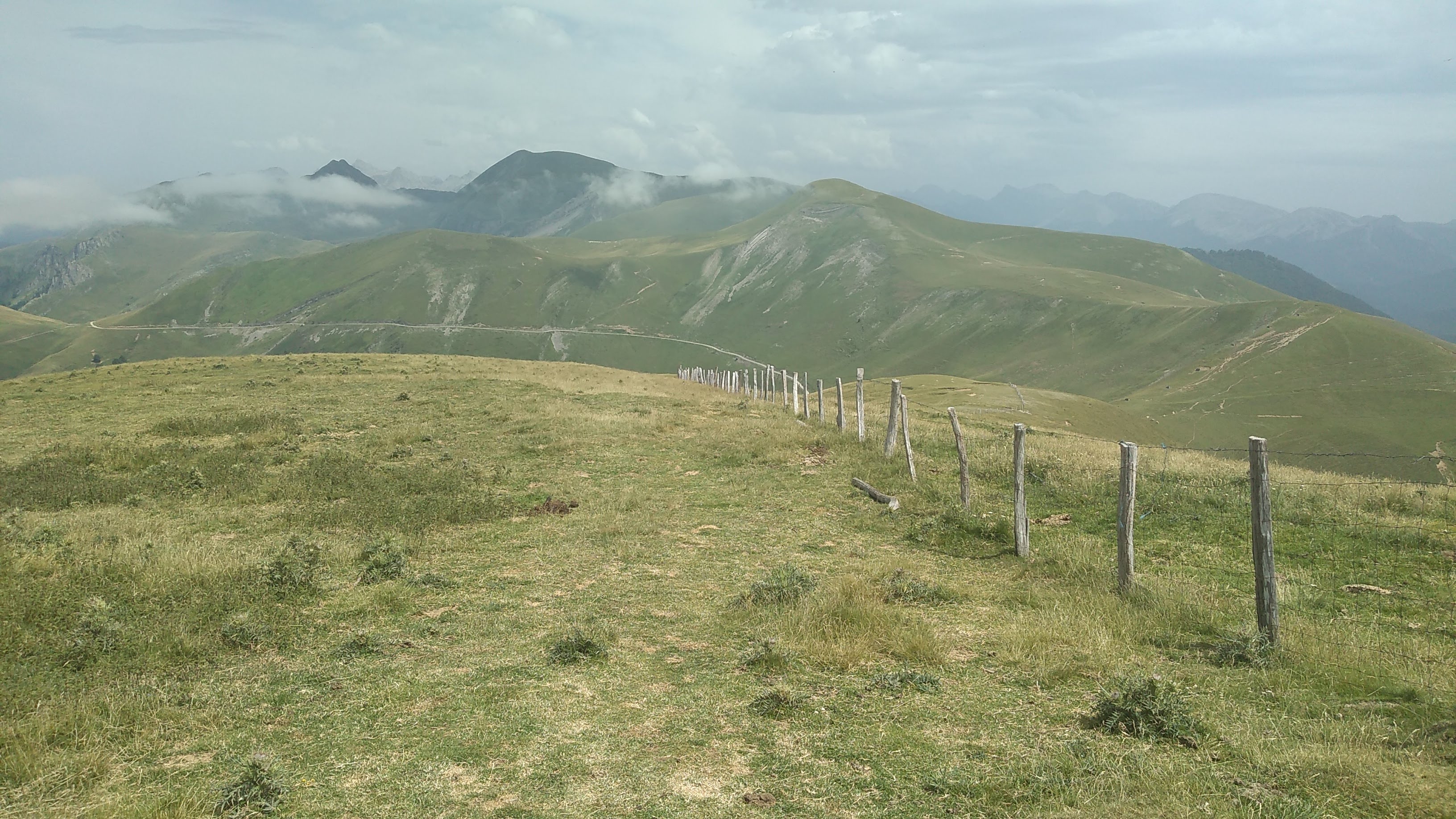
Here, though, the HRP coincides with a Spanish GR and that means red and white stripes. This made a big difference and things weren't anything like as bad as I experienced on the Pic d'Anie. After about 4 hours I arrived at the Col d'Anaye on the border and descended into France to the source of the Marmitou where I stopped for lunch and filled up my hydration system. By now it's obvious I'll get home tonight, it's just a question of when.

At the Col d'Anaye, looking down into France; Lescun is under the clouds

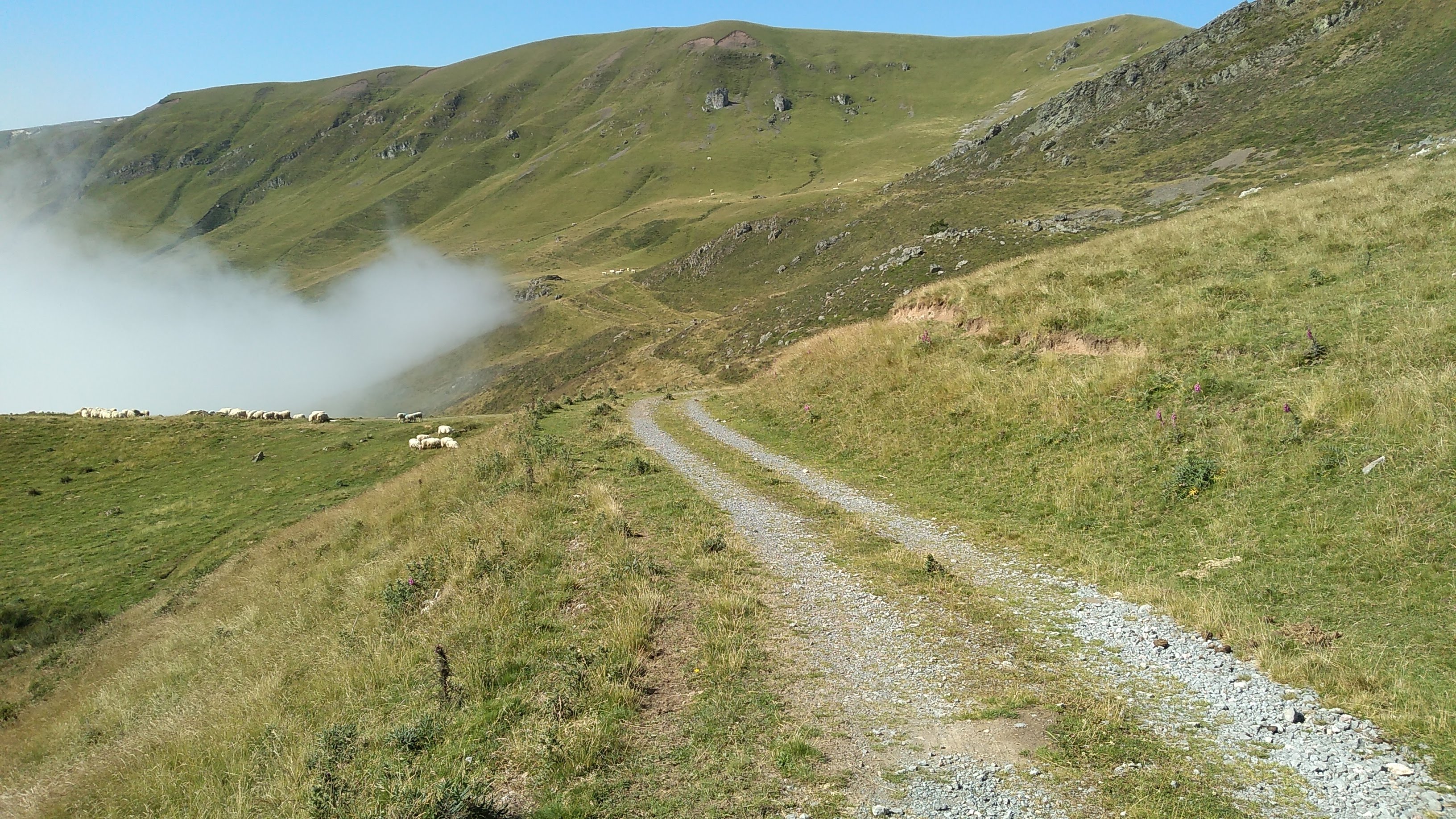
There followed some long but very simple walking downhill to Lescun under the clouds. I'd never been into the village before and took some time to explore it. At this point I started walking to the station, hoping to hitch a lift - but there were no cars! I'd covered a couple of kilometers before the first car arrived, I stuck out my thumb and ….  it stopped for me!

Arriving in Lescun

The driver turns out to be the gardienne at the Refuge de l'Abérouat, a refuge near Lescun on the GR10. She tells me she's got to do some shopping at the local supermarket but then she'll drop me off at the station. I do a quick calculation and it means I can get the train at 5.30 pm. And that's how it works out - I'm back in Pau just after 7 pm and home just after 7.30. 

The train back to Pau

I've finally got the HRP started!

Monday, July 4, 2022

Day 8 - Cabane d'Ardené to Refugio de Belagua

I've got a relatively short day to the Refugio de Belagua today, so I'm not in too much of a hurry to get up. My two young friends are debating how much further than me they are going to hike today - either an extra 4 hrs (in guidebook time) or 7 hrs. I get up as they are leaving and wish them a good day. I have a leisurely breakfast and then comes the moment I've been dreading - putting my wet gear back on.

Walking on a faint path on a compass bearing back to the frontier ridge
 
I start hiking and I'm still in the mist; I follow a very faint path on a compass bearing and pop out of the mist just below the frontier ridge. The hike follows the ridge again, but it detours below the bigger, rockier summits, first on the Spanish side, then on the French side before going back over to the Spanish side. From here there is a long, gradual descent to the hut; there were clouds spilling over a pass (the Port d'Ourdayté) from France, putting me back in the mist for part of the descent.
Horses just before the Port de Belhay

Clouds spilling over the Port d'Ourdayté; the hut is a white dot in the center

The Refugio de Belagua has been closed since 2004 and only re-opened recently. It's only at 1428 m - most huts are higher, typically above 2000 meters. And it's right beside a road and a big car park! There's not many mountain huts where motor bikers stop for lunch, but this is one. That aside, it was very nice and felt very modern; I got installed in a dormitory, had a shower and then had a beer at the bar. 

The evening meal was very good; it had two soups - gazpacho (a cold soup) and then a more traditional lentil soup. By the time I went to bed I discovered the dormitory was full up and there was a snorer. This gave me a chance to use the most valuable bit of hiking equipment measured by either price or weight - earplugs. I slept soundly and I hope the others had packed their earplugs!

Sunday, July 3, 2022

Day 7 - Col Bagargui to Cabane d'Ardené

Today is a long day that pretty much follows the frontier ridge all day. In the process, you climb the Pic d'Ohry - at just over 2000 m it's the highest peak so far on the hike. Accommodation is in an unmanned cabane and this lends a bit of uncertainty to the day - you don't know if you'll be alone or there will be a crowd there. Because it's a long day and there's no water on the trail, I take some extra water in addition to my usual 2 liter hydration system. 

The mist clears and progress improves

The forecast gives a 50% chance of storms from around 8.00 pm, so I start hiking by 9.00 am. I make good progress for the first half hour or so but then I'm in the clouds and can only see about 10 meters ahead. There isn't really a path (or, rather, there are lots of paths made by cows) and there are no landmarks to follow, so I'm navigating by map and compass and progress slows a lot. I'm looking at my map and concluding I need to follow a dirt road when the mist clears and I can see the route beyond the dirt road all the way to …. the Pic d'Ohry. Quite a relief! 


Approaching the base of the Pic d'Ohry and second breakfast

The hike continues in clear air until I get to the bottom of the Pic d'Ohry where I stop for a second breakfast and admire the hill - it's a big lump. The climb is pretty steep; from time to time there is a nice breeze blowing from the south, but, when it isn't there, it's a hot and sweaty climb. About halfway up the climb there's a sharp little ridge to cross. By the time I reach the summit I've made up for the time I lost in the mist and I'm back on guidebook schedule. From the summit I descend down the ridge to the Port de Larrau (a col where a road crosses the frontier) and stop for a bit of a break (and get back off guidebook schedule!).

Vulture just beside the Port de Larrau; there are lots of raptors on the ridge

The hike continues along the border ridge but it's rounded now, and the ups and downs are more reasonable. It's very pleasant hiking but I'm keeping one eye on the clouds over in Spain and it's obvious there will be a storm this evening. There's a steep descent to the north of the ridge I can use to reach a dirt road leading to the cabane if the storm arrives too soon, but I continue along the ridge. When I arrive at the Col Elhurrosoko I head down to the cabane just as distant rumblings of thunder can be heard over in Spain. 

Pleasant hiking on the rounded frontier ridge

I'm well down from the ridge with my rain jacket on when the storm arrives at around 5.00 pm. It's heavy rain and then grape-sized hail with distant peals of thunder; my rain jacket does a great job of keeping my top half dry but very quickly the rest of me is soaked. I splash downwards, passing cows and horses that look as miserable as I feel. The rain has just stopped when I arrive at the cabane and I'm greeted by 2 young guys doing the HRP who just beat the storm. 

I get changed and make some tea and share some cake with my fellow HRPers. They are doing what they call double days; each day, they hike 2 day's worth of the HRP. Today, they had a 'rest day' by only doing a single day! By this time, the sun is shining again but only for about 15 minutes before the mist descends on us for the night.

Later on a French guy doing the HRP in the opposite direction arrives. We all cook our own meals and go to bed. I sleep fine until my super-light air mattress (Thermarest Uberlite) springs a leak - I sleep less well after that.


Saturday, July 2, 2022

Day 6 - Egurgui to Col Bagargui

Towards the top of the pathless slope, looking back on yesterday's hiking

I had seen a forecast back in Roncesvalles that predicted 30C temperatures today, so I made an early start. The day started with a climb up a steep grass slope where the guidebook warns you that there really isn't any path. It sounds a bit ominous but it turned out to be fairly reasonable. It's an open slope, the gradient eases after the start, you can see where you need to get to and the lack of a path means you don't need to worry about losing the trail! After about an hour of climbing I arrived at a ridge where I joined a decent path and headed north east.

Joining a decent path below the ridge of Urkulu

After a couple of hours of relatively flat hiking, first contouring a slope then across a plateau, I joined the GR10. After some of the hiking on the last two days this felt like a motorway! There wasn't any shade and the temperature was rising, so when the trail descended from the Plateau d'Okabe into a wood, I took the opportunity of having a shady lunch. 

Following the GR10 on the Plateau d'Okabe; Pic d'Ohry in the distance

I resumed hiking with a descent through woods and then a hot walk along an unshaded valley road. The day's hiking ended with a climb through woods up to the Chalets d'Iraty. There I booked into my night's accommodation, the gîte d'étape at the Col Bagargui, and visited a small food shop where I bought myself a well earned ice cream and some supplies for the next few days. I took my evening meal in a resto beside the gîte, and very nice it was too!

Friday, July 1, 2022

HRP Day 5 - Roncesvalles to Egurgui

After my rest (or bad weather) day in La Posada, I'm glad to see it's dry but Roncesvalles is at nearly 1000 m and it's still in the clouds. The day starts with a walk uphill back to the col and then a gradual climb in the mist to the Col Lepoeder. 

Emerging slowly from the mist

For the next 30 minutes or so, I'm walking on the Camino as the sky clears. The pilgrims are headed in the other direction and there are lots of them - I seem to be exchanging "Bon Camino" every 2 minutes or so! Crossing the Pyrénées is a big day for the pilgrims and they'll soon be heading downhill to Roncesvalles and then out of the mountains. There are also little memorials to pilgrims that died as well as emergency communications and a shelter. It was fun while it lasted, but I was quite glad when the HRP left the Camino behind.

Potoks and the cromlech at the Col d'Organbidé

As the hike progresses, we're getting higher and the scenery is more open with fewer trees and bigger hills. The hiking followed the border fairly closely and I had lunch beside the cromlech at the Col d'Orgambidé. The hiking continued with wonderful views, including the appearance of the Pic d'Orhy that I'll be climbing in 2 days. There were lots of raptors and at one point I thought I'd get a photo of a vulture eating a dead sheep, but my presence spooked it. After a bunch more climbing and a gradual descent, I reached my destination for the night at Egurgui (there are many spellings…). In my day's hiking, the only buildings I passed were a grand total of 4 shepherd huts. 

Open scenery with the Pic d'Ohry hidden in clouds

There is an unmanned cabane where one used to be able to spend the night, but it's now closed. Apart from that, all there is at Egurgui is a stream and a track - so it's a bivvy for tonight! The stream flows well but there are sheep and cows around so I treat the water with a double dose of tablets. There's a good flat bivvy site down by the stream, so I get installed there and cook myself a curry (well, I add boiling water to a dehydrated curry meal).  Later on I settle down for the night and sleep well.

Wednesday, June 29, 2022

HRP Day 4 - Aldudes to Roncesvalles

The first three days of the hike were in rolling green hills from village to village, with lots of accommodation and eating options in the morning and evening. That pattern will continue today, but then the hike changes a bit; there will be fewer villages and I need to be more self-sufficient, which means a heavier pack. There's a post office in Aldudes, and I've sent a food parcel there. The post office is only open between 10 am and noon, so I can't hang around too long in the morning.

After a very nice breakfast, I head to the post office and collect my food parcel. I also sent my umbrella and an 'old' map home. I pick up a couple of snacks at the local store and talk to some fellow HRPers. The weather is great for hiking - dry and clear but not too hot - and my pack is still fairly light as I head out for the day.

Arriving at the start of the long high-level ridge

The first 3 hours of hiking were very nice - climbing up those steep little hills you see everywhere in the Basque country. Much of the day involved walking along a high level ridge (at around 800 m altitude) with great views in every direction. Around half distance, though, you find yourself walking on a road. There's no traffic, the views are just as good but the road is harder on the feet and a bit less interesting. 

La Redoute de Lindux (1220 meters) with its Napoleonic fortifications

Apart from a little excursion to climb a summit on the border (La Redoute de Lindux, 1220 m) you stay on the road until you arrive at the Col de Roncevaux and by then my feet were quite uncomfortable; strange, I've never had any foot problems when hiking before.

Corridor outside my room in La Posada

A short descent from the col took me to my hotel in Roncesvalles, La Posada. It's an old hotel (built at the beginning of the 17th century) and it's got a lot of atmosphere. My room is big, with a comfy bed and a private bathroom, but it's also quite spartan. Tomorrow's forecast is poor and I decided to spend two nights here (bivvying in the rain isn't much fun, especially with minimalist gear) before resuming my hike. 

Tuesday, June 28, 2022

HRP Day 3 - Elizondo to Aldudes

The weather is lovely in the morning, I've got an easy day's hiking and I'm headed to a nice hotel in France. I'm definitely in a better mood today than I was yesterday! I have an excellent, leisurely breakfast, explore the town a bit and hit the trail around 11 am. I'm going to follow the GR11 for 3 hours or so and then cut across the border and descend to Aldudes. The route I'll be taking is marked as the HRP on my map but the guidebook describes a different route; there are many versions of the HRP!

View on the climb out of Elizondo on the GR11

It's a pleasant, gradual climb through woods on the GR11 and, given yesterday's weather, it's surprising how dry everything is. Towards the top of the climb I encounter some of the hikers I passed yesterday and we continue together to the border where the scenery opens up, giving great views into the Aldudes valley. I stop for a leisurely lunch and leave them to pursue the hike. After lunch I leave the GR11 and head along a ridge line that soon offers a descent to a road. A long and increasingly hot descent follows and I'm quite relieved when I arrive at the hotel (the St Sylvestre). 

View into the Aldudes valley - my hotel is down there somewhere

Everything in the hotel is very nice. I enjoy a lazy end to the afternoon before an excellent meal. Quite a relief after yesterday's hiking!

Monday, June 27, 2022

HRP Day 2 - Bera to Elizondo

We're not in the mountains yet and even in good weather the terrain is difficult to navigate (with forests, restricted views and lots of junctions). The dire weather will make navigation more painful (with the inconvenience of being in the clouds, the risk of wet maps etc) so I've decided to follow the GR11 all the way to Elizondo today. Much of the route is common with the HRP but by sticking with the GR11, I can reduce navigation to following red and white stripes. According to the GR11 information panel in Bera it's a 9 hour 20 minute day, so there isn't a lot of time to mess around.

I have a great breakfast in the bar beside the hotel, then head into town to buy a lunch sandwich and hit the trail. The rain is never horribly heavy but it's always there. Given the forecast, I've brought an umbrella to try out; sometimes it helps (when the rain is heavy and the trail is easy) and sometimes it is a hindrance (when I'd like to use my walking poles going down a steep slope). There's a lot of climbing and descending and I focus on keeping a good, steady pace and looking out for these wonderful red and white stripes.

Apart from a 5 minute break to eat my sandwich, I kept going all day. The last 8 km to Elizondo were gently downhill and I passed some fellow HRP hikers there. My feet had been soaked all day and were a bit uncomfortable towards the end. But, after an 8 hour day, I arrived in Elizondo and, just like that, the rain stopped. 

Elizondo and typical Basque architecture

Bera and Elizondo both seem quite typical of Basque towns on the Spanish side of the border (or, as the Basques say, the southern Basque country). You find the same solid buildings and general tidiness that you find on the French side, but more of the buildings are apartment blocks rather than big individual houses. 

Even modern buildings share the traditional architecture

I find my hotel (the Hotel Elizondo) and get installed; the immediate priority is a shower and changing into dry clothes. I'm feeling better by the time I wash my hiking gear and start the process of drying everything. Later I go out to a bar for my evening meal and neither French nor English work. But the barmaid understood enough of my horrible Spanish and I ate and drank well. Fortunately, the forecast is much better tomorrow!


Sunday, June 26, 2022

HRP Day 1 - Hendaye to Bera

I had planned to start the hike 4 days ago but delayed things because the forecast was very wet. However, over the last 4 days the new forecast has got gradually worse and it is now almost as bad as when I delayed things. Today should be wet from time to time and tomorrow looks horrible, with heavy rain from dawn till dusk. As a result, I've changed my destination tonight to Bera, in Spain, where I've been able to book a hotel, the Hostal Zalain. 

Today is a Sunday and that has made the planning a bit tight. The earliest train gets me to the Hendaye just before 11.00 and the reception in the hotel closes early, so I can't mess around at the start. Straight out of the station and heading east, looking for the GR10's red and white stripes. I soon picked them out and started following them. There are a few marginal (almost spurious) differences between the GR10 and the HRP at the start; I just followed the GR10 to save navigation time.

Getting out of Hendaye and into the countryside went smoothly and I was soon hiking in rolling hills and heading towards la Rhune, a well known Basque hill. There were lots of short, sharp ups and downs before I took a tunnel under the motorway and found myself on a more sustained climb. The gray weather and scenery were almost Scottish, but the rain held off and I soon arrived at the Col d'Ibardin on the border. At this point, I left the HRP and headed down to Bera on a Spanish hiking trail. 

The Town Hall (on the right) in Bera

In Bera, I passed the town hall and saw a moving memorial to the Spanish civil war (the families of Francists were expelled from the village and the memorial denoted this by metal footprints in the village square). I picked out the start of tomorrow's hike before heading to the hotel, which was actually a couple of kilometers out of town. English was my language of communication in the hotel - the patronne huffily didn't speak any English, but her staff were eager to help. My room was modest, but it had everything I needed and only cost 25 euros.

Later on I went out for a meal at a bar called Zubiondo where French worked better for communication. There was a nice family atmosphere and I watched pelote basque on the TV as I ate. 


Saturday, June 25, 2022

HRP - The Introduction

The Haute Route Pyrénéenne (or HRP) is a long distance hike. It traditionally starts in Hendaye on the Atlantic coast and pretty much follows the crest of the Pyrénées (on the France-Spain border) all the way to the Med (though, of course, it can be done in the opposite direction). The current guidebook describes it as 44 days of hiking, and these are generally pretty long days; with rest days and some bad weather people generally take somewhere between 50 and 60 days to do it.

The HRP is rather more intense than most long distance hikes (e.g. the GR5 or GR10). First, it stays high in the mountains on pretty rough terrain; at times, it is more like a mountaineering route. Huts are further apart in the Pyrénées than the Alps and you're seldom near a village, so you often have a choice between really long days to get to accommodation or camping. Navigation is also an issue; there are no red and white stripes to mark the HRP and sometimes there really isn't a discernable path. 

I live locally and I don't plan to do it all in one go. Instead I'll do it in sections over the next 2 or 3 years. My approach is to carry very light bivouac gear but to use huts when it makes sense (maybe 70% of the nights). I had planned to start the hike a couple of years ago but Covid 19 (and the associated health measures) put paid to that. But I'll be heading to the start of the hike by train tomorrow morning. I intend to do the first of the HRP's 5 sections, Hendaye to Lescun, which should be 9 days of hiking, before the summer 'busy' season.


Wednesday, September 4, 2019

La Cirque de Gavarnie and la Breche de Roland

La Grande Cascade
I finally got round to visiting two places today on a hike. The first was the Cirque de Gavarnie, a huge wall of cliffs that looms above the village. The hike to the cirque is very popular with all sorts of tourists but I left them behind at the cirque. I climbed up the wall via the Echelle des Sarradets, a simple but sensational route with great views over to the Grande Cascade - said to be the highest free-standing waterfall in Europe. After that, some more gentle hiking took me up to my bivouac for the night and a nasty surprise - I had forgotten my thermarest and a chilly night awaited me!


Climbing up the French side of the Breche
Next morning I climbed up to the Breche de Roland. The frontier between France and Spain is a super sharp ridge, almost like a shark's fin, and the Breche is like a gap in the fin. It's a bit hard to explain it but it's pretty sensational when you are there. My hike took me through the Breche then some hiking on the Spanish side took me up the Taillon, a 3114 meter mountain. Then I turned round and started the long descent back to Gavarnie by a different route.


Spanish side of the Breche
I was very pleased to visit both places, but it was a little bittersweet. Just 30 years the climb up to the Breche was all on a glacier; it must have felt much more like the high mountains. Today, the glacier is almost gone and you do the climbing up a dusty moraine (like a heap of gravel). For about 20 meters you walk over the tiny remnant of the glacier; it is pink with algae - the darker color helps the melting and the melting helps the algae. It's the same story throughout the Pyrénées - they may be glacier free in 30 years. Climate change is a concern of mine (I have started a website on the topic); while glacier loss in the Pyrénées is a relatively minor consequence it's still sad. 


Some pics.


Tuesday, July 16, 2019

Le Palas

Le Palas (or Pic Palas)  is a highish (almost 3000 meters), rocky peak near the Refuge d'Arrémoulit. It can be climbed in a very long day, but I took the lazy approach and elected for an overnight bivouac near the hut. The route up to the hut starts with a long hot slog up a sunny valley to a col; the path then turns right and works its way to the Passage d'Orteig, an easy but very exposed traverse protected by a cable. You don't strictly need to cross the passage to reach the hut (it can be bypassed with an extra 45 minutes or so of hiking) and various signs dissuaded the inexperienced from taking it. But - of course - it was fun!

The refuge is a small, rather primitive one and lots of people were bivvying around it so I moved some distance away and found a nice spot at a small lake. The next morning I set off early and worked my way through boulders to the start of the (somewhat) technical climbing. A sharp exposed ridge on wonderful rock lead to the summit, with great views in all directions. The descent back to the car in the heat of the day seemed very long, but - a benefit of climbing with bivvy gear - I was able to stop at midday and cook myself lunch!

Some pics

Tuesday, July 2, 2019

Le Tour du Pic du Midi d'Ossau

The Pic du Midi d'Ossau is probably the most famous mountain in this part of the Pyrénées. I climbed it last year but there's an interesting long hike around it I've been meaning to do. There are a number of tempting extensions to this tour but the hike then gets a bit long for a day. But, as I've got some new bivy gear I wanted to try out, an overnight hike made a lot of sense.

The weather around Pau has been cool and overcast but with an inversion, so it looked likely the mountains would be above the clouds. And so it proved; after hiking up through the forest in the clouds I popped out to clear skies. Some gentle hiking took me to my bivouac for the night, at around 2200 meters, just below the Col de Suzon. During the night there was lightning on the plains to the north and it made for interesting viewing.

There was a lot of hiking the next day, much of it spectacular with the Pic du Midi always in view. The best scenery was out the west of the peak around the Lac Bersau and the Refuge d'Ayous. I finished the day with a climb up the Pic d'Ayous and then a long descent back to the car.

Some pics.


Wednesday, October 24, 2018

Le Pic d'Anie

Le Pic d'Anie is a nice sharp mountain at just over 2500 meters. It's further west than the highest peaks and dominates the mountains around it; from other peaks, you often recognize it in the view. Given that, it seemed like a good mountain to climb...

The climb started from a deserted ski-resort, Pierre Saint Martin. I'd been hiking for about 20 minutes when a figure appeared walking towards me. As it got nearer, things got stranger; he definitely seemed dressed as a cowboy. He passed without a word, avoiding eye contact. Strange... A few minutes later I crested a rise and found a film set; they weren't filming at that precise moment. A woman was sitting down beside a stage coach, drinking coffee, dressed as a rancher's wife but wearing trainers - presumably the authentic footwear wasn't very comfortable.

To climb the peak, first cross the
limestone glacier!
I headed on. As I got higher I found myself in a maze of limestone, crossing crevasses, climbing up little outcrops, and generally spending very little time walking in a straight line towards my mountain. It was exactly like walking on a glacier, zigzagging between crevasses and seracs. Eventually I crossed all of this and got to the base of my peak when things became more straightforward. At the summit I stopped for a late lunch before fighting my way back across the limestone glacier; this time I found a different route, but it seemed even more time-wasting than the one I used on the way up. I was glad to get back to the car before dark!

A few pics.


Saturday, October 13, 2018

Le Moulle de Jaüt

Nearing the summit
Le Moulle de Jaüt is one of the nearest and most easily recognizable biggish mountains around Pau and an obvious hiking target for me. Today, I got a chance to climb it on a beautiful fall day. The hike starts at the top of the Col d'Aubisque - a famous cycling col I've gone over several times this summer on my bike. The col allows you to start pretty high in the mountains but there was a catch - after some flattish walking, I had to descend around 300 meters before I could start climbing my mountain. 

The fall colors were spectacular and the weather ideal. I passed a couple of cow and horse herds still up in the mountains - they'll be going down soon - with bells clanking away. The climb up went well and I was soon climbing along a narrow ridge to the summit at 2050 meters. Great views in all directions with clouds on the Spanish side of the mountains just spilling over some of the higher hills. 


Clouds on the Pic du Midi d'Ossau
One of the things I'm finding at Pau is that I feel the altitude on hikes; it's not that it slows me much, but my breathing is a bit more labored and I don't feel as good as normal. At St Andre I lived at 900 meters and started most hikes at that altitude and never really felt any effects of altitude. Here, I live at essentially sea level and many hikes start around 1600 meters and I can feel the difference, even on a relatively low mountain like Le Moulle de Jaüt. Maybe part of the problem is I haven't been hiking very much over the summer months? Anyway, I headed back down again and had the pleasure of reclimbing the 300 meters to get back to my car...

Some pics.

Sunday, August 26, 2018

Le Pic du Midi d'Ossau

I first saw the Pic du Midi d'Ossau over 20 years ago at the end of a short family hike in the Pyrénées and it made a big impression on me. Most mountains are really just big hills that can be easily walked up but this looked like a real mountain that required technical climbing. It was a lot higher and more spectacular than the surrounding mountains.

Now I'm living nearby and, of course, have to climb it. Its distinctive profile is visible from Pau and it dominates most of the Ossau valley. The easiest route up is a proper alpine route graded PD (Peu Difficile or 'a little bit difficult') with three technical pitches where a rope is often used (sometimes just for the descent). It's an hour and a half's drive away and can be climbed in a longish day or you can stay overnight at a refuge to reduce the strain. I choose the single day approach but (typically) set off a little later than I intended. 


The result was that when I arrived at the first technical pitch there were already a couple of parties roping down it. When you're climbing without a rope you really don't want to be bumping into other climbers, so I let them clear the pitch before I set off. The climbing was interesting and steep enough but pretty straightforward and on excellent rock. Eventually the angle eased and there was a fairly dull scree section before the rocky summit where I joined three Spanish climbers for an extended lunch with a view. The summit is pointed and at 2,884 meters (around 9,500 feet) there are great views in all directions.  


The summit!
Of course, what goes up has to come down again, and I descended by the same route, passing a couple of parties in the process. Once I was below the technical climbing I could relax and I realized I was pretty tired. By the time I was back at the car I was about as tired as I've been after a day's climbing but glad I'd finally got round to climbing the Pic du Midi d'Ossau!

A few pics.


Thursday, May 31, 2018

Lourdes to Pau


The Pyrénées are still in the clouds
Grande Randonnée is French for big hike and is normally shortened to GR. Their length varies a lot, but they typically take several weeks to hike (e.g. I did the GR5 in 2015 over about 4 weeks); they are big undertakings. On moving to Pau I realized that I had a GR that wasn't really very G at all and was actually doable in a day - the Chemin Henri IV or GR 782. It's basically a hike from Lourdes to Pau (or vice versa) along a roman route, following the crest of a long, low ridge. I've been looking for a chance to do it, and selected today - a cool, dryish day in an unsettled period of weather. 

So I took the 7.30 train from the station in Pau to Lourdes and found the trip a bit sobering - it seemed like a lot of terrain to cover on foot in a day; what had I let myself in for? It was drizzling in Lourdes and I loaded up with sandwiches for the 40+ km hike back to my house. The weather cleared up pretty quickly and I had pleasant hiking conditions as I ticked off the kilometers. After nearly 10 hours hiking I arrived home - tired but satisfied - just managing to beat a shower; great timing! A full GR in a day! Some pics.

Friday, April 27, 2018

Hiking in the clouds

Into the clouds...
I set off for a shortish day hike on Le Layens, a 1625 m high mountain in the Pyrénées that is used as a paraglider launch. Everything went very well until I joined the final ridge, and saw that clouds were moving in from the North. Hmmm, this wasn't in the forecast I saw. Very quickly I found myself in the clouds hiking along a long, indistinct ridge without any real paths. Finding the summit wasn't that hard (just keep going up) but after that navigation became more difficult. For the next hour or so I spent most of my time looking at my compass and peering into the mist, hoping to recognize the few landmarks on the map. Even as a hiker, the mist can be very disorienting - at one point, I thought there were a group of sheep 200 m away, only to realize it was a bunch of daffodils about 15 m away!

Anyway, I followed the intended route, even if it was a little more stressful than I expected. Near the end of the hike, I popped out of the clouds and pretty much the first thing I saw was my car, 750 meters directly below. Maybe next time I'll pack a GPS for my hikes...

Some pics.

Tuesday, April 17, 2018

Le Trône du Roi

Le Pic d'Anie from Le Trône du Roi
For the last couple weeks I've been looking at the Pyrénées, trying to work out if the snow-line was high enough to permit some hiking. Today's forecast was excellent so I decided it was worth a try and went on a hike up Le Trône du Roi. It's a popular hike on essentially the 'front-range'' of the Pyrénées - so at 1266m not a big mountain but quite a steep hike to a sharp summit and a short drive from Pau.

It all went according to plan, with excellent views of the bigger snowy peaks and a taster for more hikes to come. Some pics.

Wednesday, March 28, 2018

Le Pays de Morlaàs

Morlaàs is a little town (population around 5,000) just north of Pau. It has a lot of history (from the 9th to the 13th century, it was the capital of Béarn) but nowadays it seems more like a wealthy suburb of Pau. It's surrounded by a lot of little villages and hamlets, as well as farms, and the countryside provides a good set of hikes and bike rides (mountain and road) near my house. The terrain is flattish but there are lots of steep little lung bursting climbs for variety. There are plenty of well maintained country lanes and farm tracks, so winter mud isn't a horrible problem. I've been doing a bunch of hikes there recently, often looking S to the big peaks of the Pyrénées where I hope to be hiking come late spring. 

A few pics.